|
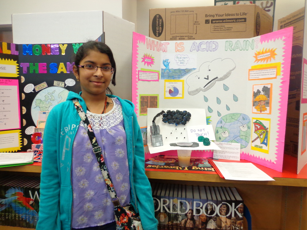
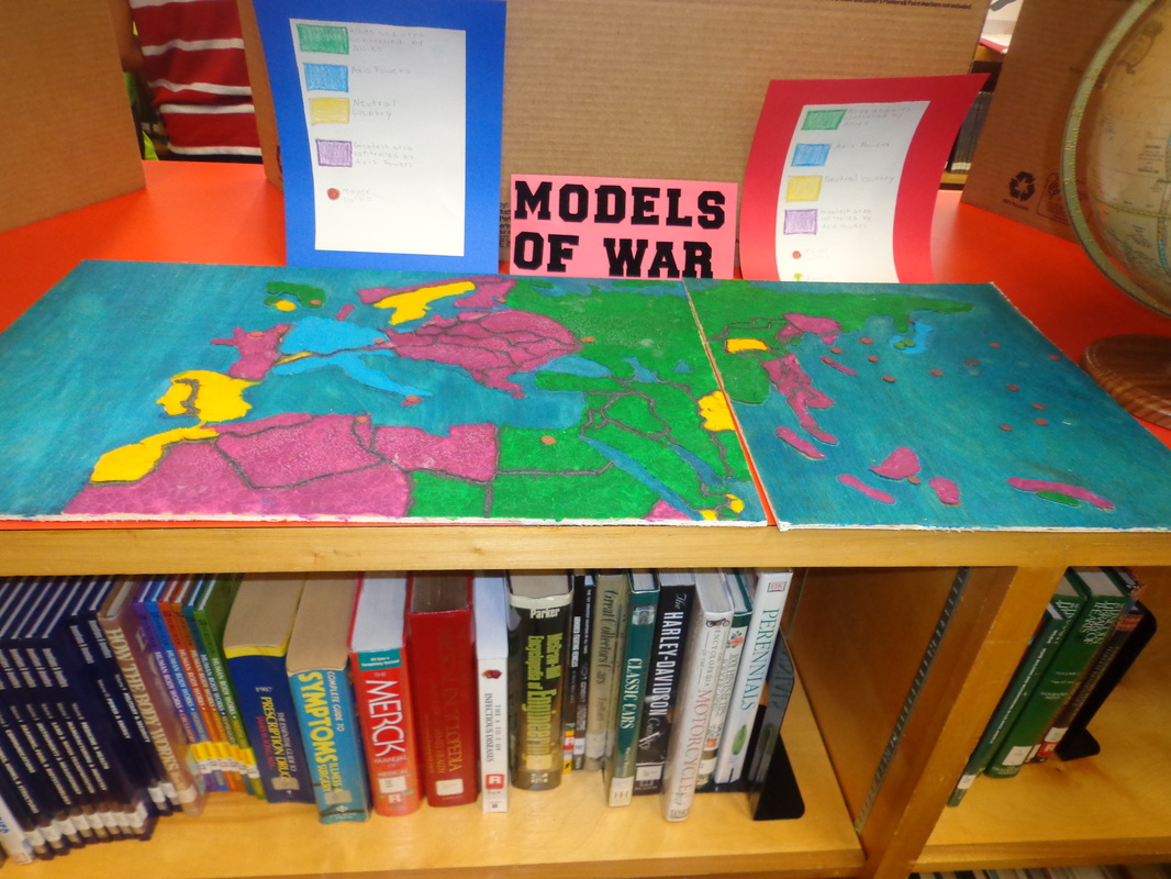
The three major environmental issues we covered last week were: acid rain in Germany, air pollution in the United Kingdom, and nuclear disaster in Chernobyl. After taking notes in a 3-section foldable, students had a choice assignment to demonstrate their understanding of these issues: 1. Environmental T-shirt 2.Danger Sign 3. Double Bubble thinking map With your child, discuss the causes (what made it happen?) and effects (what does it do to humans/the environment?) of acid rain, air pollution and the nuclear disaster in Chernobyl. 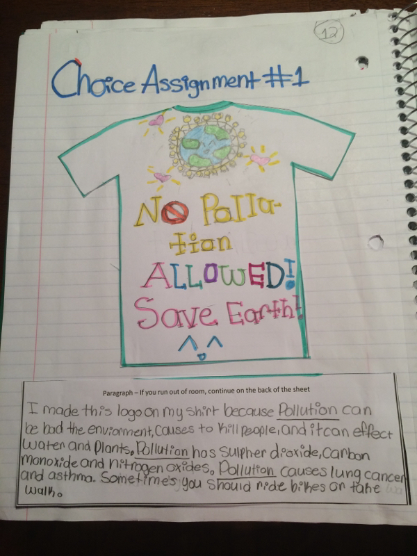 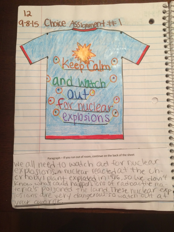 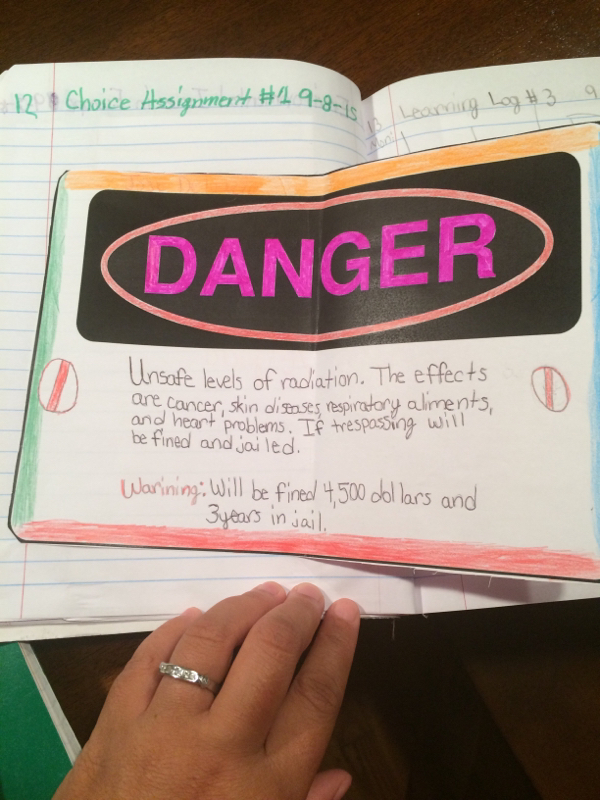 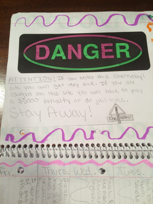 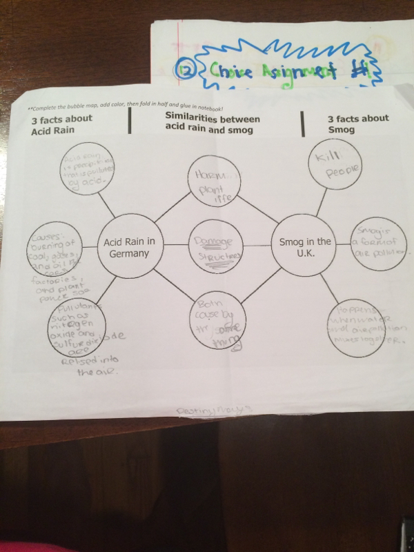 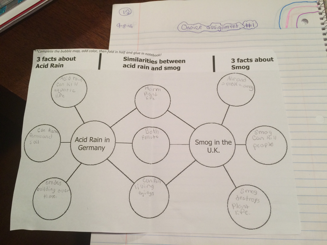 Review this video from our teacher friend from "Obertopia!".
0 Comments
Australian Physical Features: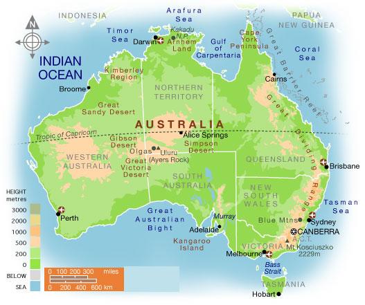 *Students should know the following features: 1. Coral Sea 2. Great Barrier Reef 3. Ayers Rock 4. Great Victoria Desert Australia Population Distribution Australia is completely surrounded by water. It is a country and a continent. It is known as the "Land Down Under" because it is located completely below the equator. The climate in northern Australia is tropical because of its proximity to the equator and the climate is more temperate in southern Australia. The coastal areas are heavily populated, with many urban cities situated near the water. The population is sparse in the center of Australia where there is a desert climate and very little rainfall. Map of Canada and North America: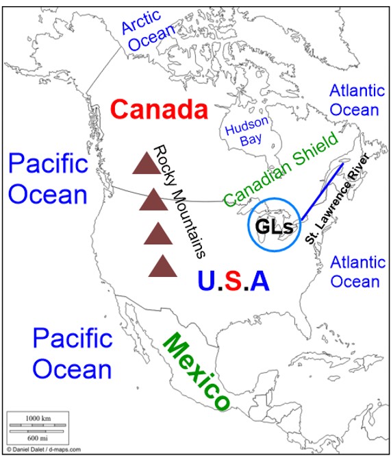 This week we are learning about the geography and population of Canada. Students need to learn and memorize the location of the following features: Pacific Ocean, Atlantic Ocean, St. Lawrence River, the Great Lakes (GLs), Hudson Bay, Rocky Mountains and the Canadian Shield. Canada Population Distribution: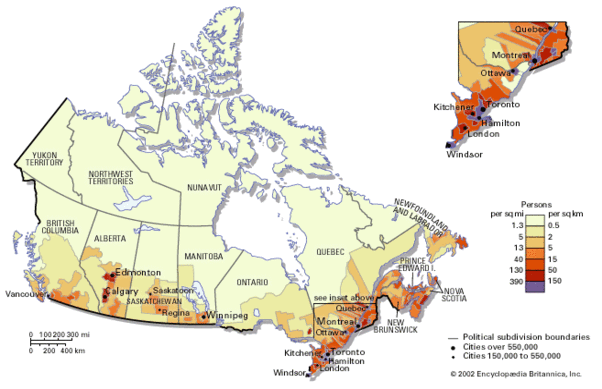 Canada is the 2nd largest country in the world in land area, 2nd to Russia. Russia and Canada have similar population distribution patterns. Both are located in the northern hemisphere, close to the Arctic Ocean where the population density is low due to the cold climate.. Just like Russia's population density is high near neighboring Europe, Canada's population density is high near the United States. Natural resources such as timber (wood) and crude oil are abundant in Canada. *Watch video clip below to learn more about population distribution in Canada: Geography: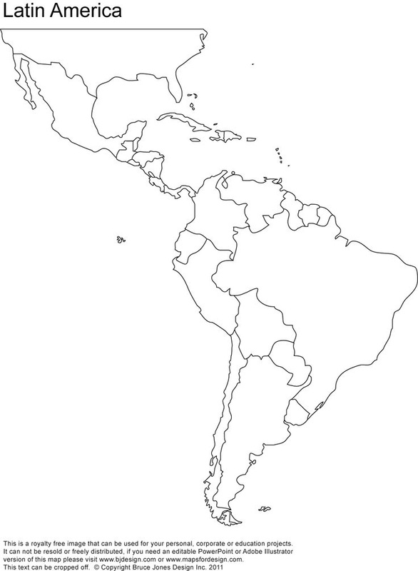
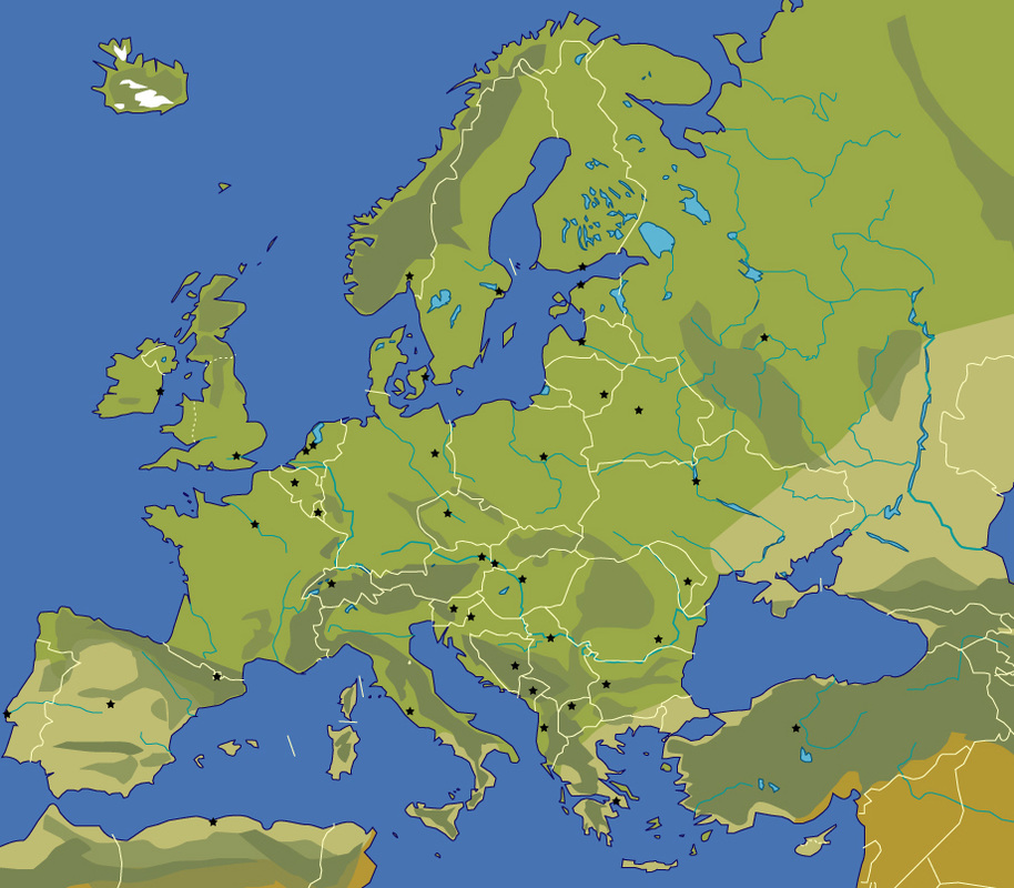
Visit this website for study help with Latin America & Caribbean geography: Population Distribution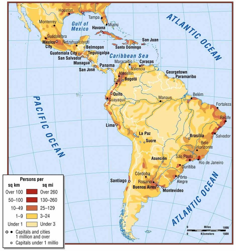 Students, as you review population distribution please remember the factors that impact where people live and why: climate, location and natural resources. Dense populations tend to be near sources of water (like rivers and lakes), water ways (the Panama Canal) and near the coast. People like to live in urban areas such as major cities. Population density is high near areas of natural resources so people can obtain what they need to survive and trade. Populations are dense where there is adequate rainfall and a moderate climate. Also, the smaller the country the more dense the population because there is limited space for people to spread out. Cuba and Haiti are examples of small countries with dense populations. Population tends to be low in deserts, in mountainous regions and in rain forests. People don't like extremes so if its too hot, too cold, too dry or too wet the population density will be low. For example, the population is sparse in the Atacama desert (too hot and dry) and the Amazon rain forest (too rainy and too much wildlife). This week our learning target is "I can explain how location, climate and natural resources impact population distribution in Europe." Population distribution means how people are spread out across a region. Let's take Georgia for example. Atlanta is the capital and a major urban city in our state. Therefore the population is very dense, or crowded, as I'm sure you know from the traffic jams! But if you go to, let's say, MONTEZUMA, Georgia, the population density is low, or sparse because not that many people choose to live there.. My 6th graders completed their first note-taking session with me using the Cornell format. I was VERY impressed with them as they defined key terms and illustrated the differences between dense and sparse and urban and rural. They also read some excerpts about how geographers study population and what factors impact where people live. Students analyzed physical, population, climate and natural resource maps to gain a better understanding of why Europe's population is unevenly distributed. Learn more about population distribution and population density in Europe by analyzing the following map and watching the video. Then discuss the following questions with your child: 1. How does climate affect where people live? 2. How do physical features impact population distribution? 3. Why do people want to live in areas with natural resources? 4. Why do major cities have high population density? 5. Why do rural areas have low population density? There will be a quiz this Friday on population. Your child has received a study guide that requires your signature. Please ensure that they study to the best of their ability! 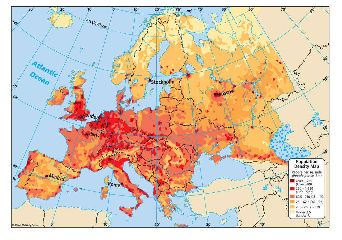 Tomorrow (Friday) students will take a quiz on selected countries and features of Europe as outlined in the Georgia Performance Standard. It is my goal that ALL students will reach 100% mastery. Parents, please quiz your child tonight and regularly to see if they can locate all of the following countries and physical features: Here is a link to the study guide. Parents please sign and return Friday:
Click the link for a map game: www.purposegames.com/game/6th-grade-europe-map-quiz-game Click the Power Point link for an additional study resource:
Countries: |
|||||||||


| social_studies_fair_due_dates.docx |


Author
Vanessa Ellis has been teaching middle grade social studies for 7 years. She is the 2017 Georgia Economics Teacher of the Year and a teacher leader in Muscogee County. She loves to teach and have FUN while doing it! Who says social studies has to be boring?

Archives
March 2017
February 2017
January 2017
December 2016
November 2016
October 2016
September 2016
August 2016
January 2016
October 2015
August 2015
 RSS Feed
